AERIAL DATA FOR INTERNATIONAL PROJECTS

Drone inspections. Aerial data.
Decide with confidence.

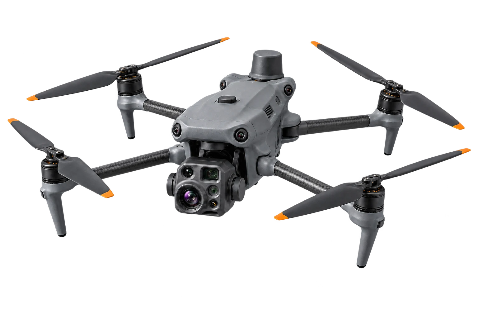
Aeronautiq Drone Solutions delivers professional RGB imagery, 4K video, thermal data, structured inspections and RTK-supported 2D/3D project material using DJI Air 3S and DJI Matrice 4T.

OPERATIONAL SYSTEMS

DJI AIR 3SDJI MATRICE 4TRGB · 4K VIDEO · THERMAL · OPTICAL ZOOM · 2D/3D · RTK

Worldwide enquiries · Feasibility confirmed for every location

Qualifications, platforms and service languages

01 · Services

One aerial partner. Six focused services.

From marketing imagery to technical observations, every flight is planned around a clear business outcome and an agreed deliverable.

Demonstration aerial video frame for a promotional projectDemonstration visual
01

Aerial photo & video

Professional aerial imagery and 4K video for property, tourism, brands and digital campaigns.

Explore service
Demonstration thermal image of a building inspectionDemonstration visual
02

Thermal drone inspections

Thermal and RGB observations of roofs, façades and installations from a safe distance.

Explore service
Demonstration thermal view of a solar PV installationDemonstration visual
03

Solar & PV inspections

Thermal and RGB capture to locate hotspots and panels requiring detailed verification.

Explore service
Demonstration aerial construction progress documentationDemonstration visual
04

Construction documentation

Repeatable aerial progress records for construction sites, land and investment projects.

Explore service
Demonstration drone inspection of technical infrastructureDemonstration visual
05

Technical drone inspections

Detailed RGB, zoom and thermal observations of hard-to-access structures and assets.

Explore service
Demonstration of RTK-supported aerial capture with orthomosaic and 3D model overlaysDemonstration visual
06

2D/3D modelling & RTK flights

RTK-supported aerial capture for orthomosaics, point clouds, textured 3D models and repeatable site records.

Explore service

02 · GUIDE PRICE CALCULATOR

See your starting budget.

Select the closest scope and enter the one-way distance. The budget automatically includes the return journey at a fixed PLN 3/km.

Suggested platformDJI Air 3S
Starting budgetfrom 550 PLNapprox. 130 EUR · guide conversion: EUR 1 ≈ PLN 4.30

Budget breakdown

Base service
550 PLN
Reporting
0 PLN
Express surcharge
0 PLN
Return travel0 km one way × 2 × 1 visit = 0 km billable × 3 PLN/km
0 PLN
Starting budget
550 PLN

This amount is a starting point, not a binding offer. It includes the entered return travel. It excludes accommodation, local fees, additional permits and certified expert work. The final price is confirmed after reviewing the project.

PROJECT BRIEF

Turn a location and objective into a clear flight brief.

Describe the site and required result. You can also ask Aeronautiq to recommend the right service.

Prepare project brief

03 · Capabilities

The right platform for the task.

Verified platform capabilities are matched to the required output: premium RGB content and repeatable documentation, or thermal, zoom, laser and RTK-supported inspection data.

01 / PREMIUM RGB

DJI Air 3S

A premium RGB platform for high-resolution photography, 4K video, panoramas, vertical social content, repeatable viewpoints and illustrative photogrammetric models.

A flexible imaging platform for polished visual content, repeatable progress records and close RGB observations where a compact C1 aircraft is appropriate.

Verified platform features

Main camera
1-inch CMOS · 50 MP · 24 mm · f/1.8
Medium tele
1/1.3-inch CMOS · 48 MP · 70 mm
Video
4K/60; 4K/120 in slow motion · 10-bit HLG / D-Log M
Photography
JPEG + DNG/RAW · panorama · AEB · interval
Operation
C1 · up to 45 min in DJI laboratory conditions · saved waypoint routes
Safety sensing
Omnidirectional vision + forward LiDAR for obstacle sensing

What Aeronautiq can deliver with Air 3S

  • Promotional 4K films for property, hospitality, tourism, industry and investment projects
  • High-resolution aerial photography for websites, catalogues, listings and campaigns
  • Recurring construction and site documentation from saved routes and reference viewpoints
  • Visible-light checks of roofs, façades, chimneys, PV panels and hard-to-access elements
  • Wide and 70 mm detail views from a safer stand-off distance
  • Panoramas, HDR imagery, hyperlapse and vertical 2.7K social content
  • Landscape, road, plot and project-surroundings documentation
  • Overlapping RGB imagery for illustrative photogrammetric 2D/3D models
Official DJI Air 3S specification
02 / ENTERPRISE THERMAL + RTK

DJI Matrice 4T

A professional platform for radiometric thermal capture, long-range visual inspection, night support, laser-assisted observations and RTK-supported 2D/3D data collection.

An enterprise inspection platform combining three visible-light cameras, radiometric thermal imaging, night support, laser rangefinding and integrated RTK positioning.

Verified platform features

Visible cameras
3 × 48 MP · 24 mm, 70 mm and 168 mm equivalents
Thermal
640×512 / 30 Hz radiometric · 1280×1024 Super Resolution
Temperature
Spot and area measurement · −20 to 550°C across gain modes
Rangefinder
Laser measurement up to 1,800 m under DJI test conditions
Positioning
Integrated RTK · centimetre-level aircraft positioning when fixed
Operation
C2 · up to 49 min in DJI laboratory conditions · night and smart mission tools

What Aeronautiq can deliver with Matrice 4T

  • Thermal and RGB screening of roofs, façades, building envelopes and industrial installations
  • PV hotspot screening and structured material for ground verification
  • Detailed visible-light inspections of power assets, masts, chimneys, bridges and hard-to-access structures
  • RTK-supported imagery for documentary orthomosaics, point clouds and 3D models
  • Construction progress, damage and post-event documentation with overview and telephoto context
  • Laser-assisted target location, distance, line and area observations for field coordination
  • Low-light, night, forestry, fire-hotspot and environmental observations where lawful
  • Search and emergency situational support when coordinated with the responsible services
Official DJI Matrice 4 Series specification

04 · Transparency

Clear examples, honestly labelled.

All project imagery and scenarios shown on this website are demonstration examples. They do not represent named clients or completed client assignments.

Demonstration of RTK-supported aerial capture with orthomosaic and 3D model overlays
Demonstration visual
Demonstration thermal image of a building inspection
Demonstration visual
Demonstration aerial video frame for a promotional project
Demonstration visual

05 · Guides

Prepare the project before take-off.

Practical guides to starting budgets, thermal inspections, PV, construction monitoring and RTK-supported 2D/3D photogrammetry.

Demonstration aerial documentation of construction progress
Demonstration visual

PRACTICAL GUIDE · CONSTRUCTION PROGRESS

How to plan construction progress monitoring by drone

Plan repeatable drone construction documentation: viewpoints, schedule, deliverables, file structure and information needed before the first flight.

Guide: construction progress monitoring
Demonstration of an RTK-supported flight with orthomosaic and 3D model output
Demonstration visual

PRACTICAL GUIDE · 2D, 3D AND RTK

RTK drone photogrammetry: which output does your project need?

Compare orthomosaics, point clouds and textured 3D models, and understand why RTK, control points and validation must match the intended use.

Guide: RTK photogrammetry outputs
Demonstration aerial image accompanying the drone service starting-budget guide
Demonstration visual

BUYER'S GUIDE · COSTS AND SCOPE

How much do drone services cost? Build a realistic starting budget

See how Aeronautiq's starting budget combines the selected drone service, reporting, delivery option, return travel and number of visits.

Guide: drone service costs

06 · Process

From location check to useful output.

01

Scope

We confirm the location, objective, timing and required output.

02

Feasibility

We review airspace, local rules, weather, safety and logistics.

03

Flight

The appropriate platform captures the agreed visual or thermal data.

04

Delivery

You receive organised files, edited content or structured inspection material.

07 · Qualifications

Qualified for demanding European operations.

The remote pilot holds A1/A3 and A2 certificates of competency, together with STS-01 and STS-02 competencies. Credential numbers can be made available for verification on justified request.

EUA1/A3
EUA2
EUSTS-01
EUSTS-02

Qualifications never replace the project-specific risk assessment, notifications or permits required for a particular operation.

08 · FAQ

Planning an international drone project?

01Can Aeronautiq operate anywhere in the world?+

Aeronautiq welcomes worldwide enquiries. Execution is confirmed only after reviewing local aviation rules, airspace, permits, site access, travel logistics and safety conditions. A local partner may be required in some jurisdictions.

02Is thermal imagery a technical expert opinion?+

No. Thermal material can reveal anomalies and support diagnostics, but it does not replace an opinion from an authorised specialist where one is legally or technically required.

03What will I receive after the flight?+

The delivery is agreed before the flight and may include edited photographs, a finished video, RGB or thermal images, raw files, or an organised inspection dataset.

04Are the projects shown real client assignments?+

No. The examples are explicitly demonstrational and do not use the identity or confidential data of real clients.

AERONAUTIQ · PROJECT ENQUIRIES

Tell us what you need to see.

Send the location, objective and preferred timing. Aeronautiq will review feasibility and return with a proposed scope.

Worldwide execution depends on local regulations, airspace, permits, weather, access and logistics.

PROJECT BRIEF

Prepare a project brief

Six short fields are enough to start a feasibility review.

The form saves the enquiry in the Aeronautiq project database. Email and WhatsApp remain optional contact channels. Do not enter sensitive data.